Bhubaneswar/Kolkata, May 25
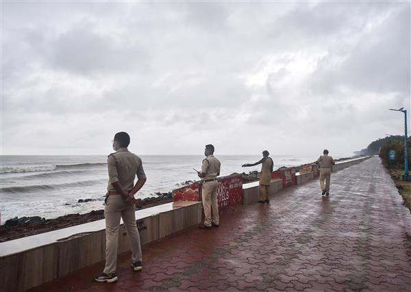
Indian authorities prepared for Cyclone ‘Yaas’ to make landfall on Wednesday morning, cancelling trains and dispatching hundreds of personnel of the National Disaster Relief Force to eastern states as the country braces for the second cyclone in as many weeks.
The Indian Meteorological department said ‘Yaas’, a severe cyclonic storm, is likely to make landfall near Dhamra Port in Odisha’s Bhadrak district early on Wednesday morning.
Dr Umashankar Das, a scientist at the Regional Meteorological Centre, Bhubaneswar said that the landfall will most likely be between Dhamra and Chandbali in the district.
IMD Director General Mrutyunjay Mohapatra said that ‘Yaas’ is likely to intensify into a Very Severe Cyclonic Storm (VSCS) by Tuesday evening and Chandbali is likely to witness the maximum damage caused by it.
“Rain has already started and will continue. Wind speeds in Kendrapara and Jagatsinghpur districts will reach around 80 kmph by midnight,” he said.
He said the impact will be severe for six hours before and after the landfall.
“Big trees and electric poles may get uprooted.
Chandbali is likely to witness the maximum damage due to the cyclone,” Mohapatra said.
Chief Minister Naveen Patnaik has rushed Odisha’s Minister of State for Home, D S Mishra to Balasore to monitor the situation in the northern parts of the state.
Official sources said that the evacuation process is underway in full swing in the coastal districts and over 50,000 people have been taken to safe shelters till noon.
The process will be completed by afternoon, much before ‘Yaas’ nears the coast, they said.
The evacuation of people is being carried out keeping in view the IMD’s warning of a tidal surge of around 2-4.5 metres during the landfall.
‘Yaas’ is likely to move north-northwestwards and intensify further into a VSCS during the next 12 hours, the IMD said in its latest bulletin issued at 9.10 am on Tuesday.
The system has been moving north-northwestwards at a speed of 10 kmph during the past six hours. It lays centred around 320 km south-southeast of Paradip (Odisha), 430 km south-southeast of Balasore (Odisha) and 420 km south- southeast of Digha (West Bengal) at 5.30 am, it said.
Squally wind speeds reaching 50-60 kmph gusting to 70 kmph are prevailing over north Bay of Bengal and along and off Andhra Pradesh-Odisha-West Bengal-Bangladesh coasts, the weatherman said.
Wind speeds will increase to 155-165 kmph gusting to 185 kmph over northwest Bay of Bengal and along and off north Odisha and adjoining West Bengal coasts including Jagatsinghpur, Kendrapara, Bhadrak, Balasore districts of Odisha during landfall, it said.
In Odisha’s Mayurbhanj district and West Bengal’s Purba Medinipur and South 24 Parganas districts, wind speeds may increase to 100-120 kmph gusting to 145 kmph.
Wind speeds reaching 80-90 kmph gusting to 110 kmph will prevail over Odisha’s Puri, Cuttack, Khurda and Jajpur districts and West Bengal’s Jhargram, Paschim Medinipur and North 24 Parganas districts during the period.
The system is likely to cause heavy rain over large parts of West Bengal and Odisha on Tuesday and Wednesday.
‘Yaas’ is also expected to cause a storm surge of 2-4 metres along the coastline of Purba Medinipur and 1-2 metres in South 24 Parganas.
The weatherman advised fishermen against venturing out into the sea till further information.
It warned of destruction to thatched houses, extensive damage to kutcha dwellings and some damage to pucca buildings in coastal and adjoining interior districts of West Bengal.
The MeT Department also warned of bending or uprooting of electric poles and disruption of railway services due to snapping of power lines and signalling systems.
The South Eastern Railways has announced the cancellation of several passenger special trains till Wednesday.
The National Disaster Response Force (NDRF) has earmarked its highest-ever number of teams for deployment in Odisha and West Bengal.
The federal contingency force has committed a total of 112 teams for deployment in five states and the Union Territory of Andaman and Nicobar Islands which are expected to be affected by the cyclone developing in the Bay of Bengal.
Out of these, the highest the number of 52 teams are designated for Odisha followed by 45 teams for West Bengal.
The rest of the teams are being stationed in states like Andhra Pradesh, Tamil Nadu, Jharkhand and the UT of Andaman and Nicobar Islands.
NDRF Director General S N Pradhan said in a tweet that this was this was the “highest ever” commitment of its teams in the two states of Odisha and West Bengal.
A senior official said the number of NDRF teams earmarked for these two states during past cyclones have never been this high.
Teams in these two states can also be enhanced if the states require or situation demands, he added.
Each NDRF team has 47 personnel who are equipped with tree and pole cutters, communication gadgets, inflatable boats and basic medical aid.
These teams, along with various disaster combat and mitigation units, are presently carrying out evacuation and awareness drives in the affected areas so that no lives are lost, the senior officer said.
Pradhan had told on Monday that at least 50 more teams have been kept as backup at its various country-wide bases and they can be airlifted for cyclone Yaas duties as and when required.
Discussions
Discussions
